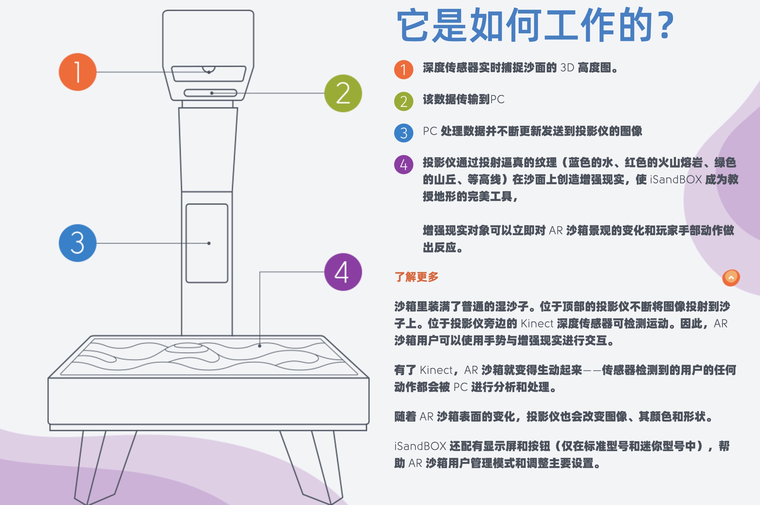
The AR geography teaching sand table system integrates interactive technologies such as real-time terrain capture system, image recognition, and depth detection. Firstly, the system optimizes and denoises the high-fidelity image data within the projection sand table, being able to provide high-quality three-dimensional data in real time. Then, through the GPU computing processing program, it performs real-time rendering on vertices according to different operation objects and conducts gradient transitions in different depth layers.This system can make the projected images gradually present landforms such as continental shelves, coasts, lands, lakes, rivers, hills, and snow-capped mountains as the height of the sand pile increases. Meanwhile, according to different scenarios, it can also demonstrate the impact of terrain on the natural environment and human activities, as well as the changes of the natural environment caused by human activities. With its advanced technology and rich display functions, the AR geography sand table system provides a brand-new visual tool for fields such as geography teaching and scientific research.
- Tel: 18751324180
- Email: 609928105@qq.com
- Add: Room 1306, Building 2, Shangyi SOHO, No. 1818 Gudun Road, Liangzhu Street, Yuhang District, Hangzhou City, Zhejiang Province


